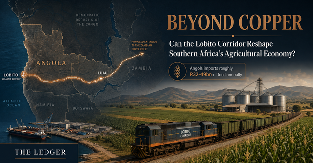
Angola contains the ingredients of an agricultural power and the trade balance of a food-deficit economy. More than 58 million hectares of arable land sit across a country with abundant water, several agro-ecological zones and a labour force in which agriculture still supports more than half of workers. Yet the country spends roughly $3 billion a year importing food.
That contradiction is usually described as a problem of agricultural productivity. It is that, but it is also something more physical: a problem of economic distance.
At the same time, a different part of Angola’s economic geography is being reconstructed at unusual speed. The Lobito Atlantic Railway now operates the 1,289-kilometre Angolan section of the Benguela line under a 30-year concession, linking the Atlantic port of Lobito to Luau on the border with the Democratic Republic of Congo. The project has secured $753 million in financing, including a $553 million loan from the U.S. International Development Finance Corporation and financing from the Development Bank of Southern Africa. DFC expects the rehabilitation to raise transport capacity from roughly 0.4 million tonnes at the end of 2024 to 4.6 million tonnes and reduce mineral transport costs by as much as 30%.
The geopolitical logic is clear. Copper and cobalt from the DRC and Zambia need faster, more diversified routes to global markets. Lobito gives the Copperbelt an Atlantic outlet.
But minerals explain why the capital is arriving. They do not necessarily determine where its economic impact ends.
The railway built for copper
The Lobito Corridor is one of the clearest examples of how geopolitics has returned to infrastructure finance. Critical-mineral supply chains have become strategic assets. The DRC is central to global cobalt production and the Zambia–DRC Copperbelt is expected to matter increasingly as electrification raises long-run demand for copper.
For decades, much of the region’s mineral output has depended on long routes toward ports on Africa’s eastern and southern coasts. Lobito alters that geometry. The railway connects the Copperbelt to an Atlantic deep-water port and, according to the operator, can move freight between Lobito and Kolwezi in roughly seven days. A proposed greenfield extension through Zambia would deepen that regional connection further.
This is why the corridor is often discussed through the language of copper tonnes, port capacity and strategic competition. But a railway is not selective in its economic effects. Once transport capacity exists, the relevant question becomes what else can use it.
Agriculture is an unusually interesting test because agricultural competitiveness is deeply sensitive to logistics. A mine can justify expensive dedicated infrastructure around a high-value mineral deposit. A maize farmer cannot. Agriculture therefore reveals whether a corridor has become part of the broader economy or remains an efficient pipe between an enclave and a port.
Angola’s geography tax
A farmer does not receive the market price of maize. The farmer receives the market price minus the cost of reaching the market.
That distinction sounds elementary, but it explains much of the commercial weakness of agriculture in poorly connected regions. Every kilometre of degraded road, every extra day in transit, every bag lost to moisture and every truck returning empty expands the wedge between what a crop is worth in a terminal market and what producing it is worth at the farm gate.
This is the geography tax. It is not levied by a revenue authority, but it can be just as economically decisive. Where the tax becomes large enough, producing a surplus stops making sense.
The same mechanism operates in reverse on inputs. Fertiliser that lands cheaply at Lobito can become expensive by the time it reaches an inland farm. When transport and financing costs multiply the delivered price, application rates fall. Low input use then holds yields down, which makes each truckload even less efficient, reinforcing the trap.
The logic is supported by a wide development-economics literature. Work from the former Zaire and Madagascar has shown that isolation and poor roads widen rural–urban price spreads and suppress input adoption. Donaldson’s historical work on Indian railways demonstrated the inverse: lower trade costs reduced spatial price gaps and raised real incomes. The lesson is not that every railway generates development. It is that market access changes the return to production.
The road before the railway
The most important kilometre of the Benguela Railway may be the kilometre that is not part of the railway at all.
A heavy rail line is designed to move bulk freight cheaply between terminals. Crops, however, are produced across dispersed farms. A farmer 30 kilometres from a railhead does not experience a low rail tariff until those first 30 kilometres are economically traversable.
This is why corridor development can fail even when the trunk infrastructure succeeds. If tertiary roads become impassable in the rainy season, a cheap 500-kilometre rail journey can be overwhelmed by an expensive 30-kilometre truck journey. Without aggregation, a train also has nothing economical to collect. Without drying and storage, grain may deteriorate while producers wait for sufficient volume. Without working capital, farmers cannot finance the production increase that the new market access supposedly makes profitable.
Angola’s own grain strategy recognises this problem. Planagrão targets roughly two million hectares for expanded production of wheat, rice, soybeans and maize, with a goal of more than six million tonnes of grains and legumes. Importantly, the plan does not allocate capital only to farms. It explicitly includes access roads and other supporting infrastructure. That is a recognition that production targets without distribution architecture are little more than acreage targets.
When distance becomes margin
The power of infrastructure is easiest to see at the level of a single tonne.
Take a stylised grain movement from the Central Plateau toward the coast. Under a road-heavy system, assume long-haul trucking at $0.18 per tonne-kilometre and significant handling and post-harvest losses. Under an integrated corridor system, shift the long haul onto rail, retain a shorter feeder-road leg and reduce spoilage through aggregation and storage.
The assumptions below are intentionally transparent. Change the distance or first-mile requirement and the economics update immediately.
This is what infrastructure does economically: it can convert distance into margin.
Suppose lower logistics losses allow a meaningful portion of the saving to pass back to the farm gate. Suddenly a farmer’s decision about hybrid seed, fertiliser or mechanised land preparation changes. A production input that looked uneconomic at a low farmgate price can become rational at a higher one. Increased output then improves aggregation economics, which lowers unit costs again.
This is also where credit enters the story. Infrastructure does not eliminate agricultural risk, but it can change the cash-flow profile that lenders underwrite. Better market access, lower spoilage and contracted offtake can reduce some of the uncertainty around revenue realisation. That creates the possibility—not the guarantee—of financing production that was previously too marginal or too isolated.
Angola’s agricultural paradox
The scale of the opportunity becomes clearer when placed beside the existing food import bill.
USDA data shows that Angola’s food and agricultural imports exceeded $2.1 billion in 2024. The World Bank’s 2026 AgriConnect framework places the broader annual food-import burden at approximately $3 billion. That is not simply evidence of food insecurity. It is a visible domestic demand pool that local value chains are failing to capture.
The immediate opportunity, therefore, may not be exporting Angolan agriculture to Europe or Asia. It may be replacing imports already consumed in Luanda, Lobito and other domestic markets.
That changes the investment logic. Domestic substitution does not require Angola to become the world’s lowest-cost agricultural producer. It requires local production to become competitive with the landed and distributed cost of an imported alternative.
The agricultural map hidden inside Lobito
The corridor also cuts across markedly different production environments. That matters because “agriculture” is not one homogeneous opportunity. The infrastructure required by soybeans on the Central Plateau is different from the infrastructure required by horticulture near Benguela or cassava in the east.
Benguela · Coastal gateway
The corridor terminates in a coastal province where irrigation, urban demand and port access create a different economics from the interior. The opportunity is less about bulk grain production and more about cold-chain logistics, horticulture, poultry finishing, processing and export handling.
Huambo and Bié are the most obvious grain-belt candidates. Higher altitude, relatively strong rainfall and a history of cereal production make the Central Plateau a natural location for maize, soybeans and wheat. The corridor matters here because bulk grains need aggregation and cheap long-haul movement. A tonne of soy that can reach a feed mill economically is more valuable than a tonne stranded near the farm.
Moxico represents a different frontier. It is vast, relatively water-rich and historically isolated from Angola’s main coastal consumption centres. Planagrão identifies the east as a strategic grain-expansion zone. If road and rail access improves, the commercial question shifts from “can this land produce?” to “which value chains can process and move what it produces?” Cassava is a good example: its perishability makes local starch or flour processing more important than simply loading fresh roots onto a train.
Benguela, meanwhile, sits at the opposite end of the system. It is where logistics, processing, cold storage, port infrastructure and consumer demand converge. This makes the corridor less a line on a map than a sequence of complementary economic functions.
Angola’s first export market may be Angola
The most compelling value-chain example is poultry.
Angola imports hundreds of millions of dollars of poultry and meat products. Yet the economics of a domestic chicken begin much further upstream than the broiler house. Feed—particularly maize and soybean meal—is typically the dominant cost in intensive poultry production. If inland grain cannot reach coastal feed mills at a competitive delivered price, local poultry inherits that disadvantage.
The corridor therefore does not need to generate an agricultural export miracle to matter. It could begin by making Angolan maize and soy more competitive inside Angola.
The same logic applies to rice milling, edible-oil crushing and wheat processing. Each imported food category is not merely a trade statistic; it represents an existing downstream market into which a domestic supply chain might insert itself if production, logistics and processing costs align.
| Import exposure | Domestic production response | Investment layer | Economic test |
|---|---|---|---|
| Poultry & feed | Maize + soybean feed supply | Silos, feed mills, poultry integration | Can domestic feed beat landed imported inputs? |
| Rice | Commercial paddy production | Irrigation, drying, milling | Can inland rice reach consumers with consistent quality? |
| Edible oils | Soybean / oilseed production | Crushing and refining | Is throughput sufficient to keep plants economical? |
| Wheat & flour | Higher-altitude wheat production | Storage, milling, contracted offtake | Can local grain compete with imported wheat after logistics? |
From railway to corridor economy
This is where the agricultural case becomes larger than farming.
If crop volumes rise, they create demand for silos, drying facilities, warehouses, laboratory testing, seed distribution, fertiliser depots, equipment leasing, trucking, insurance and commodity finance. Processors create further demand for electricity, packaging and industrial services. Banks and development-finance institutions gain new assets to finance, but only if these value chains generate observable cash flows.
A functioning agricultural corridor therefore produces a layered economy around the transport asset. The railway carries freight; the economic system creates the freight.
This distinction is critical. A mining corridor can remain commercially viable because a handful of very large shippers guarantee volume. Agriculture is fragmented. It requires institutions capable of aggregating thousands of smaller production decisions into a reliable commercial flow.
But infrastructure is not development
There is an obvious danger in the Lobito story: assuming that because infrastructure is necessary, it is sufficient.
It is not.
A farmer can have a road and still lack title security. A processor can sit beside a railway and still fail because electricity is unreliable. A cooperative can have an offtake contract and still be unable to finance seed. A silo can be built in the wrong location. A border can erase time savings through customs delays. A bank can see the opportunity and still price agricultural credit beyond what the underlying crop margin can carry.
There is also a design problem. Infrastructure optimised around mining economics may not automatically serve agriculture. Mines generate concentrated freight at predictable nodes. Farms generate dispersed freight across wide geographies and seasonal cycles. The feeder system that maximises mineral throughput is not necessarily the feeder system that integrates rural producers.
That creates the central political-economy question of Lobito: who is the corridor actually being built to connect?
The distinction will be visible in secondary investment. If capital follows the rail line into feeder roads, aggregation centres, storage, processing, irrigation, farm finance and power, Lobito can become an economic spine. If the investment remains concentrated at mines, rail terminals and the port, it may succeed brilliantly as a mineral corridor while doing far less to reshape the productive geography around it.
The real measure of Lobito
The conventional scorecard for the Lobito Corridor will be straightforward: tonnes moved, transit days reduced, port capacity added and copper diverted toward the Atlantic.
Those metrics matter. But they are incomplete.
The deeper measure is whether the corridor changes the economics of producing anything other than minerals.
If a farmer in Huambo can sell maize profitably because freight no longer consumes the margin; if a processor in Benguela can source Angolan soy rather than imported feed; if rice grown in the east can compete with a shipment arriving from Asia; if a lender can finance production against a credible logistics and offtake system—then Lobito will have become more than a railway.
It will have begun to reorganise the economic geography of the region.
That is the difference between a transport corridor and a development corridor.
The Ledger View
Minerals are the catalyst, not necessarily the ceiling. Copper and cobalt justify the infrastructure economics today, but open-access transport can support a wider freight economy.
The first mile determines whether agriculture participates. Cheap rail cannot compensate for inaccessible farms, weak aggregation and high post-harvest losses.
Import substitution is the near-term prize. Angola already has a multibillion-dollar domestic food market. The first commercial test is not export dominance; it is whether local value chains can displace landed imports.
The investable opportunity sits between farm and railway. Storage, feed, milling, cold chain, equipment, power, logistics and agricultural finance are where a corridor can become a production system.
Sources & further reading
- World Bank — Angola AgriConnect Compact: arable land, food imports, jobs and financing targets.
- U.S. DFC — Lobito Atlantic Railway financing close: financing, rail length, capacity and expected transport-cost impact.
- Lobito Atlantic Railway: route, concession, operating status and transit information.
- USDA FAS — Angola Exporter Guide: food and agricultural import context.
- Government of Angola — Planagrão: grain-production targets, land allocation and supporting infrastructure.
- Minten & Kyle (1999); Stifel & Minten (2008); Gollin & Rogerson (2014); Donaldson (2018); Asher & Novosad (2020) — market access, transport costs and spatial development literature referenced in the underlying research.